Geology is a great science, full of surprises, you’ll never know what awaits you. These photos will make you praise even more this unique and magnificent science. They help you have a clear idea of the incredible power of nature leaving such masterpieces on our planet earth. The photos we will invite you to learn a bit of everything; physics, chemistry, geography, math, biology, engineering, and art. Time has really a fundamental role in this visual study. Indeed, it forms the very backbone of this discipline as it covers a timeline of over 4 billion years, with many separated intervals. Now, thanks to Google Earth, modern technology, and the navigation ability of the satellites we are able to admire the amazing shots of the earth, breathtaking views from the computer with no knowledge of Geology. From now till the end of this journey, you will be always on the top, on the highest point of the earth!
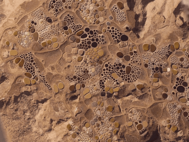
1. Same Dot Painting
No, your guess is incorrect, it is not a Dot Painting artwork by an American abstract artist; This unbelievable image is a historic and quite unusual salt-producing facility, located in the northern Niger. The principal source of precious salt extracted from clay in the Sahara where there is no sea around for thousands of kilometers. Here is pockmarked with hundreds of salt ponds filled with pastel-colored brine water, there are small hills all around some of which are 30 feet high, and they were all created by the deposition of clay from many years of salt extraction in the area.
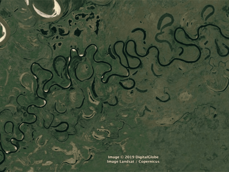
2. A visual symphony
Let’s take a tour on top of the extraordinary curves of a meandering river in North America, its sinuous course in the dense forest, this is the symphony of the wild river. Notice the center of the photo where it could be seen a curve loop is being cut off.
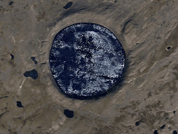
3. Magic huge craters
You may not know many things about meteorites, Meteorites are rocks from space that strike the Earth’s surface. Giant meteorites can have catastrophic effects: huge craters, bomb-like destruction, and mass extinctions of species. Such massive impacts occur on average once every 100 million years, but smaller ones much more frequently. Most meteorites come from the asteroid belt between Mars and Jupiter. Some very rare meteorites are fragments of the Moon, Mars, or comets. The space rock smashup showered Earth with up to 100 times more meteorites than today’s rate. Most are in North America, Sweden, and western Russia. There are only about 185 known impact craters on Earth of different ages, while the moon has more than 100,000. Now look at this perfect meteor crater again; It describes one of the rarest geological occurrences, don’t you think?
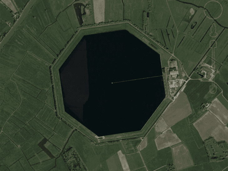
4. The man-made wonders
Now we return to other unusual facilities of producing drinking water from the polders of the Blankaart region. This huge octagonal concrete reservoir was build in 1972, measuring 120 football pitches in size (60 ha), in the IJzerbroeken, near De Blankaart nature reserve in Belgium. The reservoir can contain up to 3 million m³ of water: sufficient to supply the drinking water of one-third of the coastal province every day. This is the extensive knowledge of geographers who know very well the proper utilization of the land. Thank you very much Google Earth for capturing these man-made wonders!
5. The Roof of the World
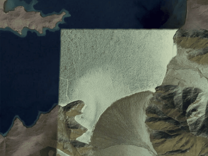
It is time to look admirably at the Tibet plateau. This is a satellite view of the Roof of the World. Do you want to know why it’s called that? Tibet is the Roof of the World because it is about 5000 meters higher than its surroundings. You can see many lakes in the heart of Tibet. It tells that this area didn’t get rains needed to make rivers long enough to reach the sea. The Eastern part of Tibet is the origin of some of the largest rivers on earth, that flows in China, Southeast Asia, and South Asia. Rivers from western Tibet reach Pakistan and central Asia. The lower part of the plateau is green and fertile because Himalayas and Karakorams on the south of the plateau get a lot of rain and snow from the Monsoon of Asia in summer and Mediterranean winds in winter. As photo explains, The Tibetan Plateau is an amazing, dynamic place where many things come together to develop large climate systems and it would be interesting mentioning that the surface temperature above the plateau increases by more than 2 degrees Fahrenheit in May due to the effect of soot on snow.
6. All blues find here
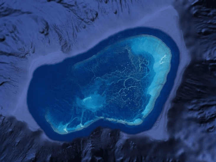
Don’t be surprised! This picture is so rare that it’s not a problem if you know very little about it. These pure and shine blue shape is the Atolls, sometimes is also called a coral atoll, has a more or less annular reef and reef-island systems that can be found mostly in oceanic mid-plate settings, where they rest on the peaks of submarine volcanic rocks. The atolls and atoll reef islands observed today are geologically young features, having formed on older foundations since global sea level stabilized about 6000 years ago. Atolls are the result of the development of tropical marine living beings, thus these islands are just found in warm tropical waters. Volcanic islands were previously considered to raise the water temperature and provide the heat needed for hermatypic living beings to get seamounts as they died down and dissolved away at the surface. Coral atolls are likewise the critical spot where dolomitization of calcite happens. At specific profundities, water is undersaturated in calcium carbonate yet immersed in dolomite. Convection made by tides and ocean streams improves this change. Aqueous streams made by volcanoes under the atoll might likewise assume an imperative role. Let’s navigate this marvelous zone by Satelite on Google Earth!
7. The moon mirrored
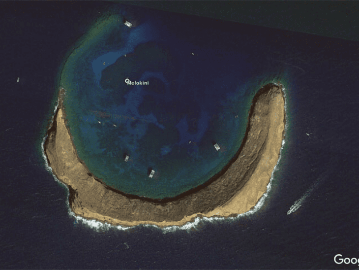
Imagine what a dream vacation could become true here when you are on a boat and following the crescent moon path and the delicious seafood lunch awaits you on the beach! Remember, you can observe this amazing satellite photo on the top of the South Pacific!
8. As the world natural heritage
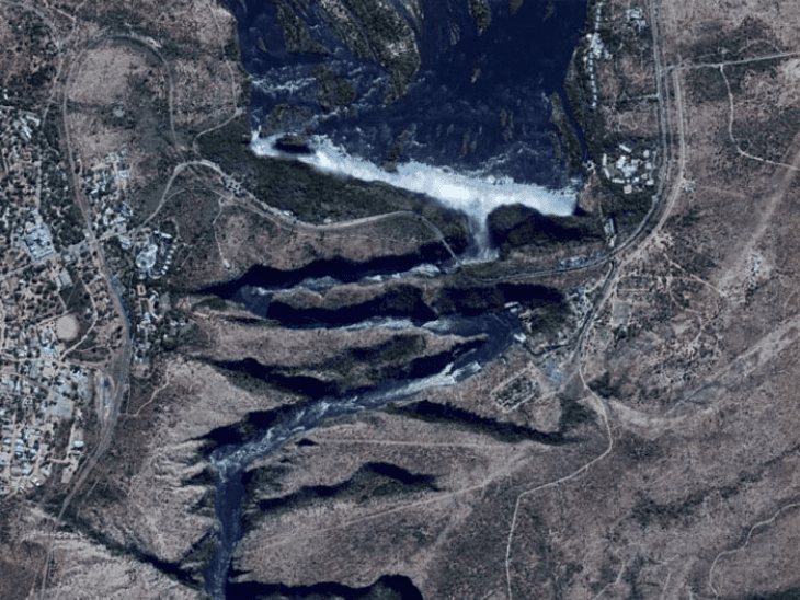
The Zambezi is the fourth-longest river in Africa, after the Nile, Congo, and Niger Rivers. It is the longest east-flowing river in Africa. Together with its tributaries, it forms the fourth largest river basin of the continent. The river flows eastward for about 3,540 kilometers from its source on the Central African Plateau to empty into the Indian Ocean. This river evokes mystery and excitement with few rivers in the world remaining as pristine or as little explored. Having an exited journey to The Zambezi River and highly recommended! Not to be disregarded, the most notable feature of the Zambezi River is the mighty Victoria Falls – one of the Seven Natural Wonders of the World and World Heritage Site.
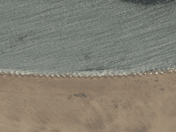
9. The saw-tooth beach
Did you see even before saw-tooth pattern on a beach? When waves approach a shoreline at an angle, though, the swash advances up the incline of the beach at an angle, moving sediment diagonally across the beach slope. The frequented cycle of splash and backwash advances the sand on a saw-tooth path along the beach.
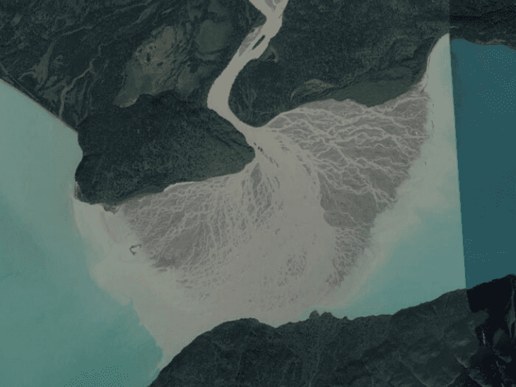
10. The green melts
This astounding piece of art is a photo of a glacier flowing out into a lake. What does it mean? A glacial lake is a body of water with origins from glacier activity. They are formed when a glacier erodes the land, and then melts, filling the depression created by the glacier. The shape of the glacier floating on the water is pretty cool!
